Regional Roads Victoria (RRV) is conducting a study for the McIvor Highway in the Longlea and Junortoun area. What part will the O’Keefe Rail Trail and its user traffic play in this study’s outcomes?
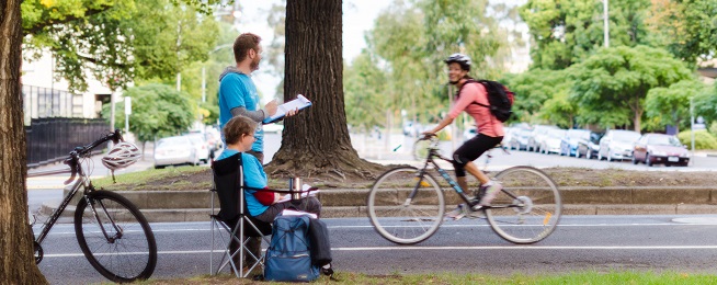
During this month of March, RRV will be counting the number of pedestrians and cyclists within the Junortoun area through which this highway passes. The active transport study will assess the typical journeys of pedestrians and cyclists, to help understand how people travel and where they might be going. Such is expected to help RRV better understand where people choose to go in the future, especially if there were to be improved paths, crossings, underpasses, and on-road lanes to provide safer access.
As an O’Keefe Rail Trail user you shouldn’t be worried, as RRV is using a number of ways to record travel information therefore such will not identify individual people.
The Friends of the Bendigo-Kilmore Rail Trail have indicated to RRV and the City of Greater Bendigo, the future need for a trail underpass at the crossing point of this highway. It is assumed that such a study will highlight the current commuter and recreational user traffic on the O’Keefe Rail Trail, especially at that point where trail users need to cross this highway with its increasingly busy traffic.
https://regionalroads.vic.gov.au/map/northern-improvements/mcivor-highway-development-project
https://www.facebook.com/524800840985926/posts/1837380126394651/
Discover more from Friends of the Bendigo-Kilmore Rail Trail
Subscribe to get the latest posts sent to your email.


